
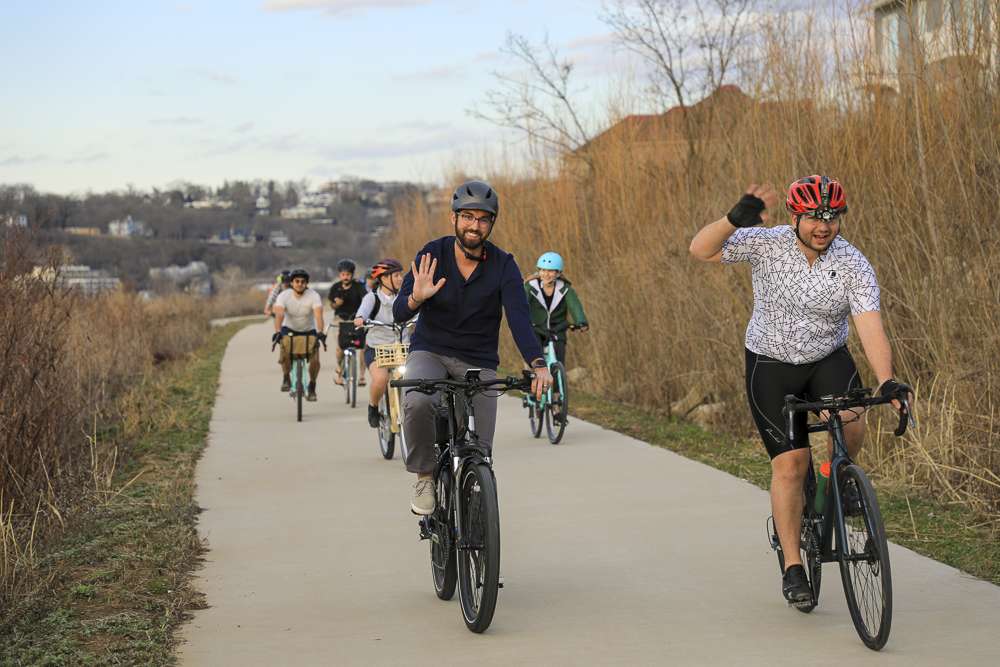
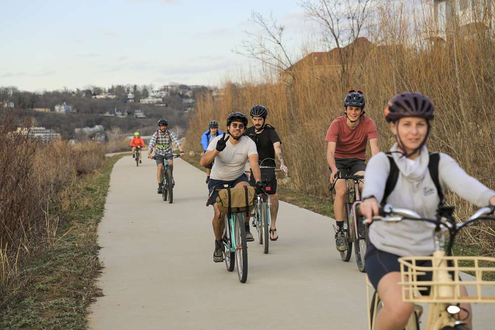
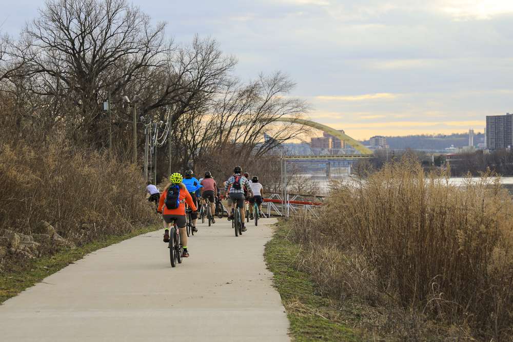
Riverfront Commons
With plans to span 11.5 miles along the south bank of the Ohio River, this Northern Kentucky trail has completed segments in Covington, Newport, and Dayton.

Originally envisioned in the early 2010s, Riverfront Commons is beginning to come to life. Dayton, Newport, and Covington have all implemented improvements to their segment of the trail corridor in recent years.
In 2021, the completed Covington Plaza project opened to the public, offering an outdoor entertainment amphitheater with stunning views of the Ohio River. The realigned trail meanders past the Robert Dafford floodwall murals with improved connections from Greenup Street to Madison Avenue. A new section of the trail is under construction at the west end of the Covington floodwall extending closer to Ludlow. Previously a gravel path, the newly paved trail will soon extend to Swain Court, separated from busy traffic along Mary Ingles Highway by a new concrete barrier.
Across the Licking River, Newport celebrated the completion of two elevated bridge connections from the Taylor-Southgate Bridge to Newport on the Levee in 2019. Improvements to the trail are currently being made near General James Taylor Park as a part of the Ovation development.
In Dayton, the city is constructing three sections of the Riverfront Commons trail. Phase I, named Ahrens’ Way Riverfront Trail, was completed in 2019. Phase II and III will add another mile to the trail along the river parallel to Manhattan Boulevard.
Who it’s great for
Commuters, joggers, walkers, urban hikers, nature lovers
What to look for
Robert Dafford floodwall murals, old homes in the Covington Historic Riverside District, John A. Roebling Suspension Bridge, Purple People Bridge, iconic views of the Cincinnati skyline
Where to visit
Ahrens’ Way Riverfront Trail, Newport on the Levee, Covington Plaza, General James Taylor Park, George Rogers Clark Park, Bellevue Beach Park, and business districts in Covington, Newport, Bellevue, and Dayton


LENGTH
Currently around 3.8 miles in length, this proposed 11.5-mile multi-use trail aims to link Northern Kentucky’s six river cities – Ludlow, Covington, Newport, Bellevue, Dayton, and Fort Thomas.
Use caution crossing the 4th Street Bridge between Newport and Covington. Walking bikes on the narrow northern side path is recommended.
TERRAIN
Paved, urban
DIFFICULTY LEVEL
Easy-moderate
END POINTS:
Dayton, Kentucky, to Covington Kentucky
COUNTIES:
Campbell and Kenton
LEARN MORE:
Southbank Partners' Riverfront Commons Storymap

-9585")
Lebanon-Countryside YMCA Trail
Lebanon-Countryside YMCA Trail
The Lebanon-Countryside YMCA Trail provides a direct, shared-use path connecting Historic Downtown Lebanon in the heart of Warren County and the Little Miami Scenic Trail, accessing numerous local attractions along the way and nearby. The paved terrain is mostly flat – with a few hills to keep things interesting throughout – providing an easy-to-moderate trail
-6793")
Oxford Area Trails
Oxford Area Trails
Oxford Area Trails make up a growing network of paved and accessible multi-use paths, connecting the wide variety of destinations the city and surrounding areas have to offer—from the Miami Natural Area Nature Paths to the city’s vibrant Uptown business district and everything in between.

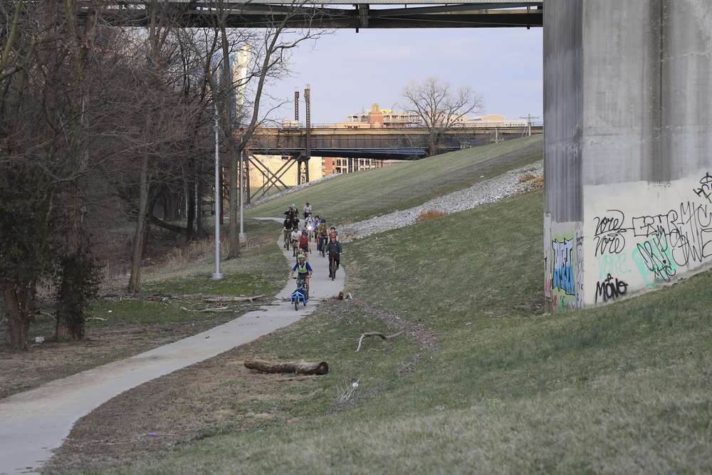
CROWN
CROWN
The CROWN (Cincinnati Riding Or Walking Network) is a vision for a 34 mile urban, off-road trail loop in the heart of the Queen City. With nearly 24 miles complete, CROWN consists of four major trails already in development: Wasson Way, Little Miami Scenic Trail, Ohio River Trail, and Mill Creek Greenway.

Wasson Way
Wasson Way
Currently the Wasson Way trail runs for 3.5 miles from Old Red Bank Road at the edge of Ault Park to Montgomery Road at the edge of Xavier University.

Whitewater Canal Trail
Whitewater Canal Trail
Following a historic canal route through Indiana’s Whitewater River Valley, this trail offers undisturbed views of aqueducts, locks and wildlife.

Licking River Greenway Trail
Licking River Greenway Trail
Covington’s riverfront boasts a 2-mile braided trail network featuring a natural surface trail along the river, a paved multi-use trail on the levee, and a series of murals.

Mill Creek Greenway Trail
Mill Creek Greenway Trail
Once infamous as one of “America’s most endangered rivers,” the Mill Creek now proudly showcases diverse wildlife, public art, and an edible forest garden along its multi-use trail.

Ohio River Trail
Ohio River Trail
This iconic trail spans 22 miles along the mighty Ohio River from Smale Park in Cincinnati to New Richmond, Ohio.
-2731")

