Ohio River Trail
The Ohio River Trail is an in-progress biking and walking thoroughfare that, once completed, will stretch from Aurora, Indiana across Hamilton County’s riverfront to New Richmond, Ohio.

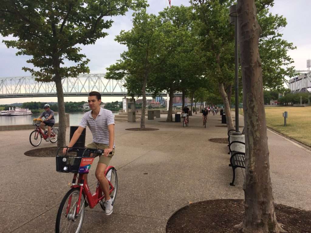
The Ohio River Trail will be an expansive walking and biking path that, once completed, will stretch 50+ miles from Dearborn County in Indiana, through western Hamilton County and Downtown Cincinnati, to Clermont County, delivering breathtaking riverfront views all along the way. The historic river corridor is part of several larger trail systems - the Ohio River Way, Ohio to Erie Trail, and U.S. Bike Route 21.
Several sections of the trail are complete today. In Southeast Indiana, segments of Dearborn Trail exist in Aurora, Lawrenceburg, and Greendale. Bike lanes run along U.S. 50 from Cleves to the western edge of Cincinnati, Ohio.
Efforts to the western portions of the trail are spearheaded by River-West.
Who it’s great for
Joggers, walkers, hikers, cyclists, visitors
What to look for
- Historic Downtown Aurora
- Fernbanks Park
- Gilday Park
- Paycor Stadium
- Smale Riverfront Park
- The Banks (entertainment district)
- National Underground Railroad Freedom Center
- Great American Ball Park (and the CROWN Mural)
- Sawyer Point
- T.M. Berry International Friendship Park
- Historic Columbia-Tusculum district
- Schmidt’s Landing & Park
- Lunken Airport (trail loop, playground, golf course and airplane viewing)
- Riverbend Music Center
- Dozens of dining options along the route, especially in Downtown and East End


LENGTH
28 miles
TERRAIN
Paved, urban
DIFFICULTY LEVEL
Easy to difficult
CONNECTING TRAILS:
Historic Downtown Aurora (Indiana) to Five Mile Road (Anderson Township)
END POINTS:
Historic Downtown Aurora (Indiana) to Five Mile Road (Anderson Township)
COUNTIES:
Dearborn (Indiana), Hamilton
LEARN MORE:
Great Parks Acquires Land for Oasis Trail through Railroad Easement. Cincinnati.com, 14 May 2024. Link.

-5644")
CVG Loop Trail
CVG Loop Trail
Led by Boone County Fiscal Court, the Tower Loop Trail has made significant progress over the past several years. Nearly all the funds needed to finish the proposed 19.2 mile trail loop have been secured. Trail planning and design is underway, with construction of several trail extensions scheduled to take place over the coming years. For
-9585")
Lebanon-Countryside YMCA Trail
Lebanon-Countryside YMCA Trail
The Lebanon-Countryside YMCA Trail provides a direct, shared-use path connecting Historic Downtown Lebanon in the heart of Warren County and the Little Miami Scenic Trail, accessing numerous local attractions along the way and nearby. The paved terrain is mostly flat – with a few hills to keep things interesting throughout – providing an easy-to-moderate trail
-6793")
Oxford Area Trails
Oxford Area Trails
Oxford Area Trails make up a growing network of paved and accessible multi-use paths, connecting the wide variety of destinations the city and surrounding areas have to offer—from the Miami Natural Area Nature Paths to the city’s vibrant Uptown business district and everything in between.

CROWN
CROWN
The CROWN (Cincinnati Riding Or Walking Network) is a vision for a 34 mile urban, off-road trail loop in the heart of the Queen City. With nearly 24 miles complete, CROWN consists of four major trails already in development: Wasson Way, Little Miami Scenic Trail, Ohio River Trail, and Mill Creek Greenway.

Wasson Way
Wasson Way
Currently the Wasson Way trail runs for 3.5 miles from Old Red Bank Road at the edge of Ault Park to Montgomery Road at the edge of Xavier University.
-8185")
Riverfront Commons
Riverfront Commons
A recreational trail project connecting northern Kentucky river cities along the Ohio River.

Whitewater Canal Trail
Whitewater Canal Trail
Following a historic canal route through Indiana’s Whitewater River Valley, this trail offers undisturbed views of aqueducts, locks and wildlife.

Licking River Greenway Trail
Licking River Greenway Trail
Covington’s riverfront boasts a 2-mile braided trail network featuring a natural surface trail along the river, a paved multi-use trail on the levee, and a series of murals.

-2731")