Mill Creek Greenway Trail
Once infamous as one of “America’s most endangered rivers,” the Mill Creek now proudly showcases diverse wildlife, public art, and an edible forest garden along its multi-use trail.

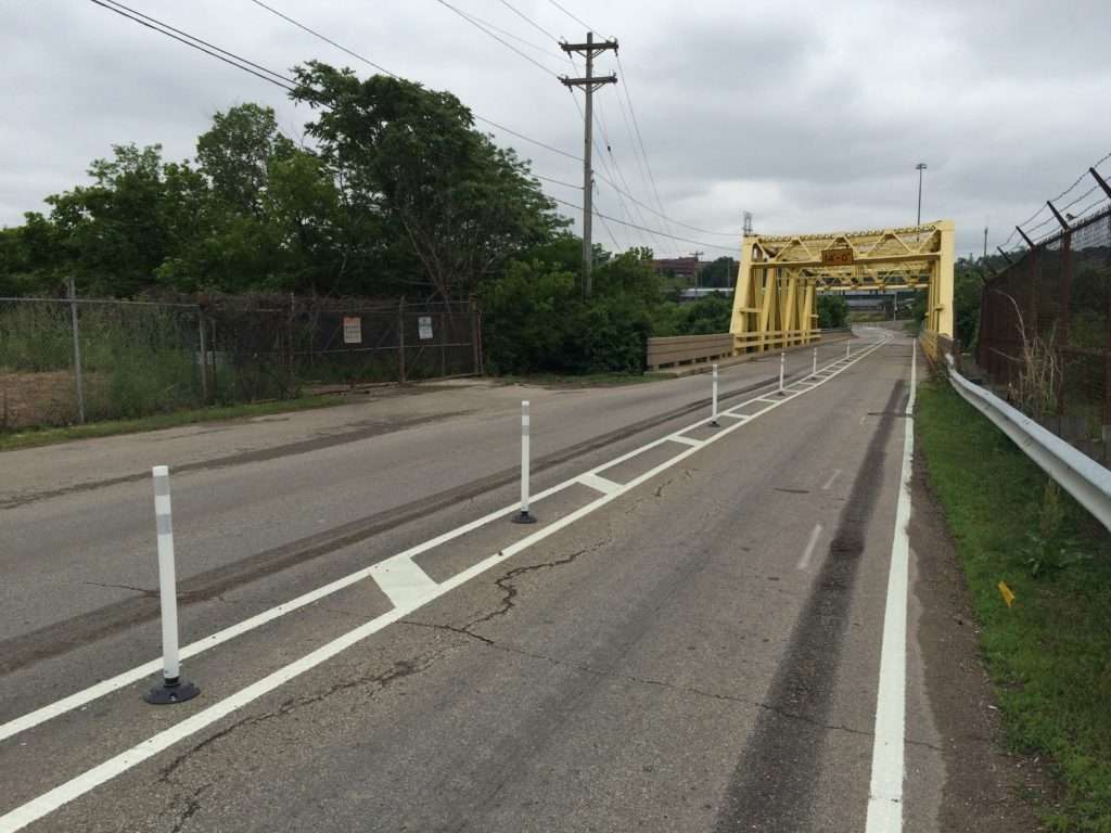
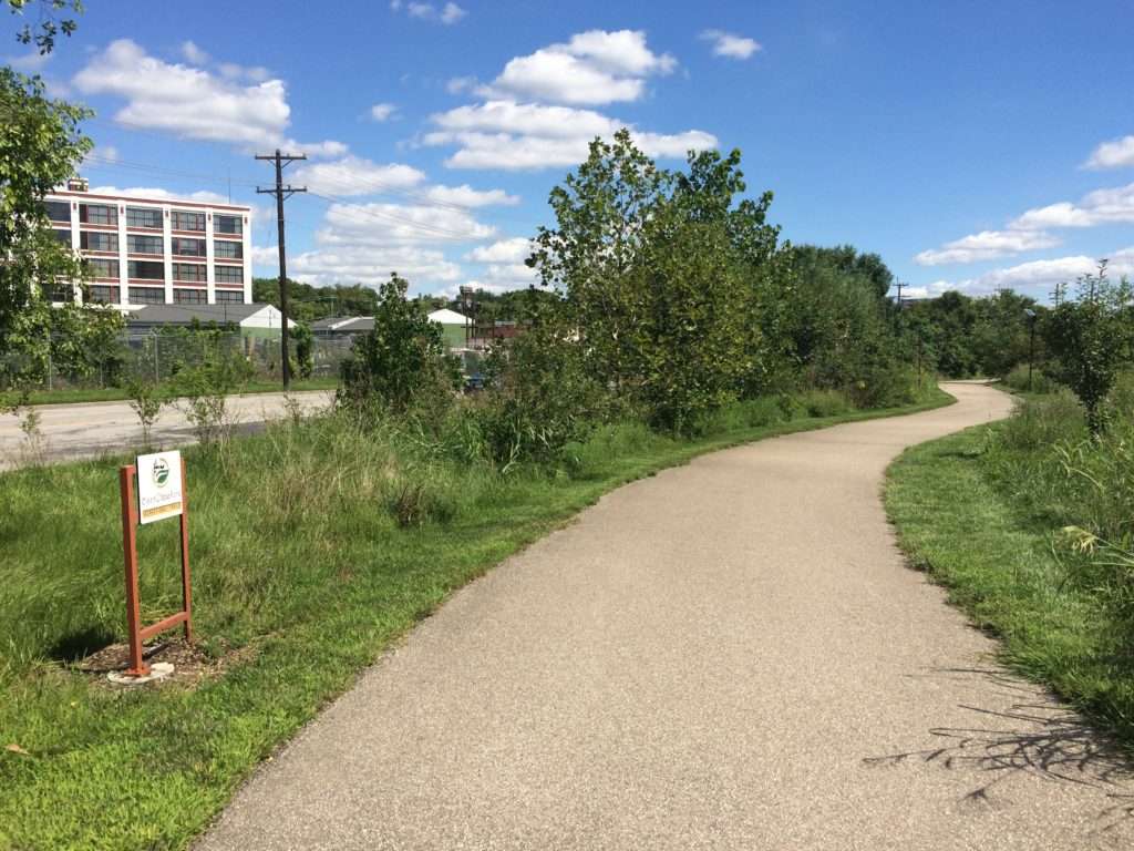
Though it runs just over three miles along historic Mill Creek now, advocates have big plans for the Mill Creek Greenway Trail. Its proposed route will one day span over 50 miles and link the Ohio River Trail in Lower Price Hill through the center of Hamilton County to Great Parks’ Winton Woods and Sharon Woods. For now, you can now ride from Camp Washington to Caldwell Park in Cincinnati using the existing 3.5 mile paved trail and 5 miles of on-road bike lane connections.
Visit the Northside section in autumn to grab a pear or apple from the Freedom Tree Edible Forest Garden. Or visit by night to explore SPACE WALK, a 3.5 billion:1 scale model of the solar system (don’t worry, it’s only ¾ mile in length!)
The Mill Creek Greenway Trail is one of several restoration projects focused on restabilizing the area’s natural habitat. These rehabilitation efforts have dramatically improved the creek’s water quality and welcomed back wildlife like catfish, muskrats, beavers and water birds. Trail advocates hope that one day the trail will follow 53 miles of the Mill Creek and its tributaries.
Parking is available at the Salway Park and Caldwell Playground trailheads.
Who it’s great for
Commuters, bicyclists, joggers, walkers
What to look for
Restored floodplains along the creek bed, helping to preserve natural habitat and restore wildlife
Where to visit
Downtown Northside, Salway Park, Spring Grove Cemetery, Caldwell Park

LENGTH
3.5 miles of paved multi-use trail, with 5 miles of nearby on-road bike lane connections
TERRAIN
Paved, urban
DIFFICULTY LEVEL
Easy
CONNECTING TRAILS:
Canal Bikeway, Spring Grove Ave Bike Lanes, Este Ave Bike Lanes
END POINTS:
Ethel Taylor School to Caldwell Playground
COUNTIES:
Hamilton
LEARN MORE:

-5644")
CVG Loop Trail
CVG Loop Trail
Led by Boone County Fiscal Court, the Tower Loop Trail has made significant progress over the past several years. Nearly all the funds needed to finish the proposed 19.2 mile trail loop have been secured. Trail planning and design is underway, with construction of several trail extensions scheduled to take place over the coming years. For
-9585")
Lebanon-Countryside YMCA Trail
Lebanon-Countryside YMCA Trail
The Lebanon-Countryside YMCA Trail provides a direct, shared-use path connecting Historic Downtown Lebanon in the heart of Warren County and the Little Miami Scenic Trail, accessing numerous local attractions along the way and nearby. The paved terrain is mostly flat – with a few hills to keep things interesting throughout – providing an easy-to-moderate trail
-6793")
Oxford Area Trails
Oxford Area Trails
Oxford Area Trails make up a growing network of paved and accessible multi-use paths, connecting the wide variety of destinations the city and surrounding areas have to offer—from the Miami Natural Area Nature Paths to the city’s vibrant Uptown business district and everything in between.

CROWN
CROWN
The CROWN (Cincinnati Riding Or Walking Network) is a vision for a 34 mile urban, off-road trail loop in the heart of the Queen City. With nearly 24 miles complete, CROWN consists of four major trails already in development: Wasson Way, Little Miami Scenic Trail, Ohio River Trail, and Mill Creek Greenway.

Wasson Way
Wasson Way
Currently the Wasson Way trail runs for 3.5 miles from Old Red Bank Road at the edge of Ault Park to Montgomery Road at the edge of Xavier University.
-8185")
Riverfront Commons
Riverfront Commons
A recreational trail project connecting northern Kentucky river cities along the Ohio River.

Whitewater Canal Trail
Whitewater Canal Trail
Following a historic canal route through Indiana’s Whitewater River Valley, this trail offers undisturbed views of aqueducts, locks and wildlife.

Licking River Greenway Trail
Licking River Greenway Trail
Covington’s riverfront boasts a 2-mile braided trail network featuring a natural surface trail along the river, a paved multi-use trail on the levee, and a series of murals.
")
Ohio River Trail
Ohio River Trail
The Ohio River Trail – part of the 300+-mile Ohio-to-Erie Trail – is an in-progress multi-use path that, once completed, will stretch from Dearborn County in southeast Indiana across Hamilton County’s riverfront to Five Mile Road in Anderson Township.
-2731")