CROWN
This 34-mile urban trail loop will complete a 104-mile active transportation network in Greater Cincinnati and transform the way people move in our communities.
About CROWN
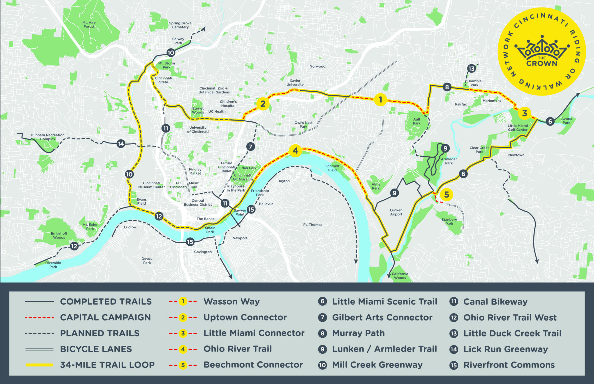
CROWN, the Cincinnati Riding Or Walking Network, is a vision for a 100+ mile active transportation network, made up of a combination of multi-use trails and on-road bike lanes. Anchored by a 34-mile trail loop that's physically separated from car traffic, this walkable and bikeable network will connect more than 356,000 people in 54 communities to major destinations like parks, schools, and centers for employment, retail, recreation and entertainment.
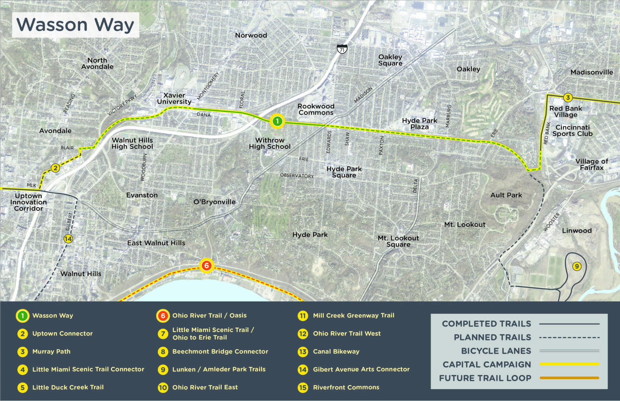
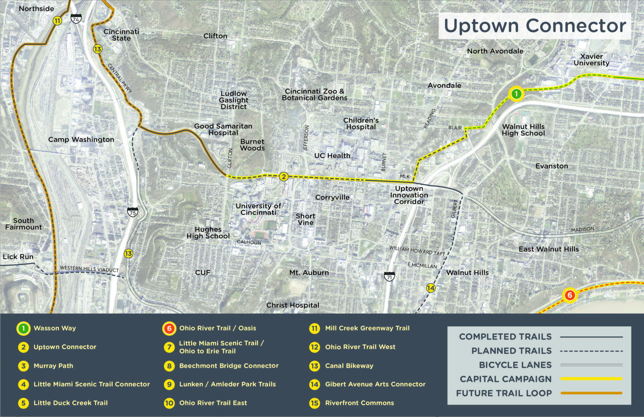
When complete, CROWN will form a network with the following trails in development: Wasson Way, Ohio River Trail East, Little Miami Scenic Trail, Ohio River Trail West, Mill Creek Greenway Trail, and Canal Bikeway. Building the CROWN will transform Cincinnati into a leading destination to live, work, and play by linking our regional trails and reconnecting our neighborhoods.
You can explore the proposed CROWN routes by scrolling through the maps below.
CROWN, the Cincinnati Riding Or Walking Network, is a vision for a 100+ mile active transportation network, made up of a combination of multi-use trails and on-road bike lanes. Anchored by a 34-mile trail loop that's physically separated from car traffic, this walkable and bikeable network will connect more than 356,000 people in 54 communities to major destinations like parks, schools, and centers for employment, retail, recreation and entertainment.
When complete, CROWN will form a network with the following trails in development: Wasson Way, Ohio River Trail East, Little Miami Scenic Trail, Ohio River Trail West, Mill Creek Greenway Trail, and Canal Bikeway. Building the CROWN will transform Cincinnati into a leading destination to live, work, and play by linking our regional trails and reconnecting our neighborhoods.
Explore the CROWN Story Map to learn more about the history of CROWN trails and the Capital Campaign.
You can explore the proposed CROWN routes by scrolling through the maps below.


Support the CROWN Campaign
Tri-State Trails has partnered with Wasson Way and Ohio River Way to launch a grassroots fundraising campaign to connect Wasson Way to Uptown and the Little Miami Scenic Trail, as well as connect the Ohio River Trail from Lunken Airport to Downtown. Become a trailblazer by making a donation today →
Quick Facts
Urban Trail Loop
Proposed distance: 34 miles
Completed: 20.4 miles
Funded: 2.8 miles
In the works: 10.8 miles
Communities impacted
54 communities
356,000 people within 1 mile
Stay in the Loop
Tri-State Trails is leading a coalition of advocates, nonprofit organizations, government agencies, businesses and institutions to make CROWN a reality. With the help of our partners, we’ve made tremendous progress. Sign up for email updates for the latest on CROWN and other projects.
In the News


